KHTS Radio Santa Clarita Radio – Santa Clarita News

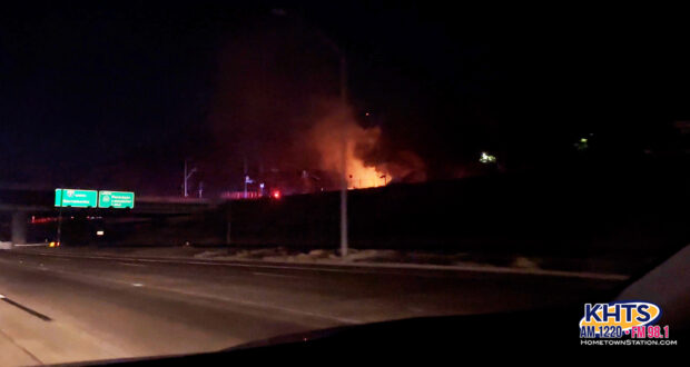
A brush fire broke out south of Santa Clarita in Sylmar near the 210 and Yarnell Street Tuesday night.
The brush fire, named the Hurst Fire, was reported at about 10:25 p.m. near the 210 and Yarnell Street in Sylmar, according to initial reports from the Los Angeles County Fire Department.
FINAL UPDATE (9 a.m. 1/16)
The Hurst Fire is now 100% contained and is mapped at 771 acres in size.
Incident Commander Fuller declared the Hurst Fire 100% contained this morning.
Crews are working to complete suppression repair efforts and anticipate that work will be completed on Monday.https://t.co/OPB7QPSZ3Q@LAFD @LACOFD @LACoFDPIO @LASDHQ @ReadyLA…
— Angeles National Forest (@Angeles_NF) January 16, 2025
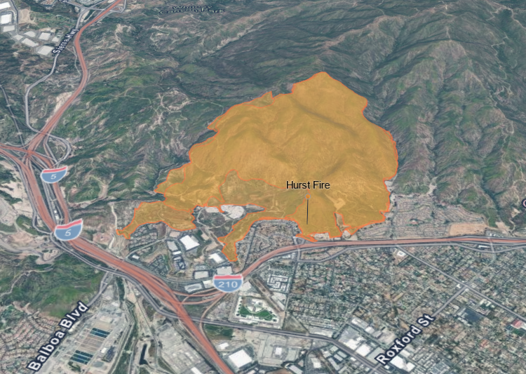
CAL FIRE
UPDATE (1:09 p.m. 1/15)
The Hurst Fire remains at 95% containment and 771 acres in size as of Wednesday afternoon, according to the Angeles National Forest. Approximately 207 personnel remain assigned to this incident.
UPDATE (1:30 p.m. 1/14)
The Hurst Fire remains at 95% containment and 771 acres in size as of Tuesday afternoon, according to the Angeles National Forest. Approximately 207 personnel remain assigned to this incident.
UPDATE (8 a.m. 1/13)
Containment on the Hurst Fire has increased to 95%, and is holding at 771 acres as of Monday morning, according to the USDA Forest Service, Angeles National Forest.
UPDATE (11 a.m. 1/12)
CAL FIRE
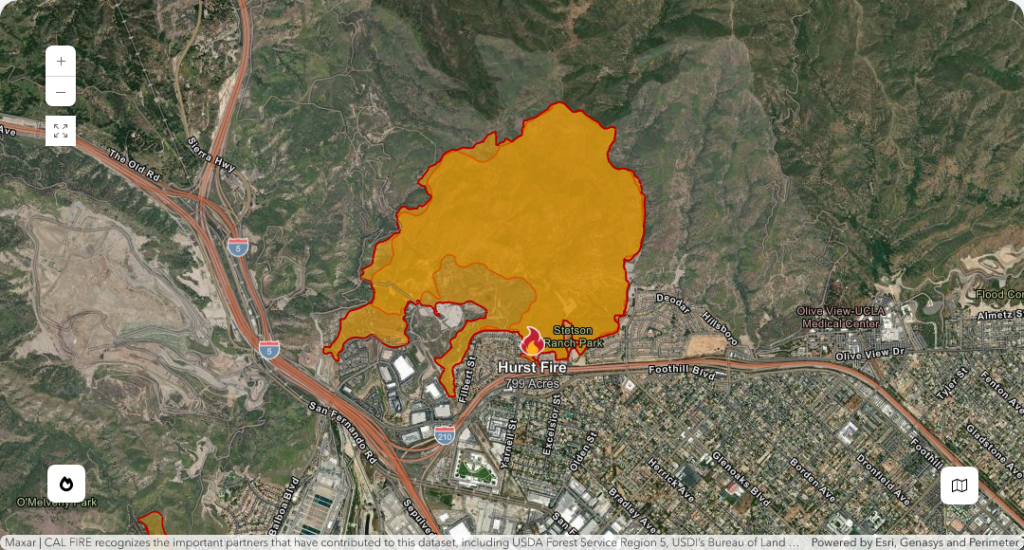
As of Sunday morning, The Hurst Fire is approximately 771 acres with 89% containment, according to officials with the Angeles National Forest (ANF). The remaining 11% of the fire control line is located on the northern edge of the fire, in “extremely steep and difficult terrain,” according to ANF.
“Firefighting efforts continue to concentrate on building and improving containment lines with a focus on public safety and structure protection. Residents returning home are advised to use extreme caution,” read a statement from CAL FIRE.
Approximately 300 personnel are assigned to the incident as of Sunday.
The entire Angeles National Forest is temporarily closed for public safety and the protection of natural resources through midnight Wednesday, Jan. 15. The closure order and prohibited activities may be found here.
Update (3:30 p.m. 1/9)
Evacuation Orders have been downgraded to Evacuation Warnings, and areas previously under Evacuation Warnings have now been lifted.
Residents returning to areas affected by the Evacuation Orders are advised not to consume tap water until further notice from the Los Angeles Department of Water & Power. Additionally, some homes may still be without power.
UPDATE (8:20 a.m. 1/9)
The Hurst Fire is approximately 855 acres with 10% containment, according to the Angeles National Forest. All evacuation orders and warnings remain in place.
For evacuation updates and zone alerts, click here or download the Genasys app.
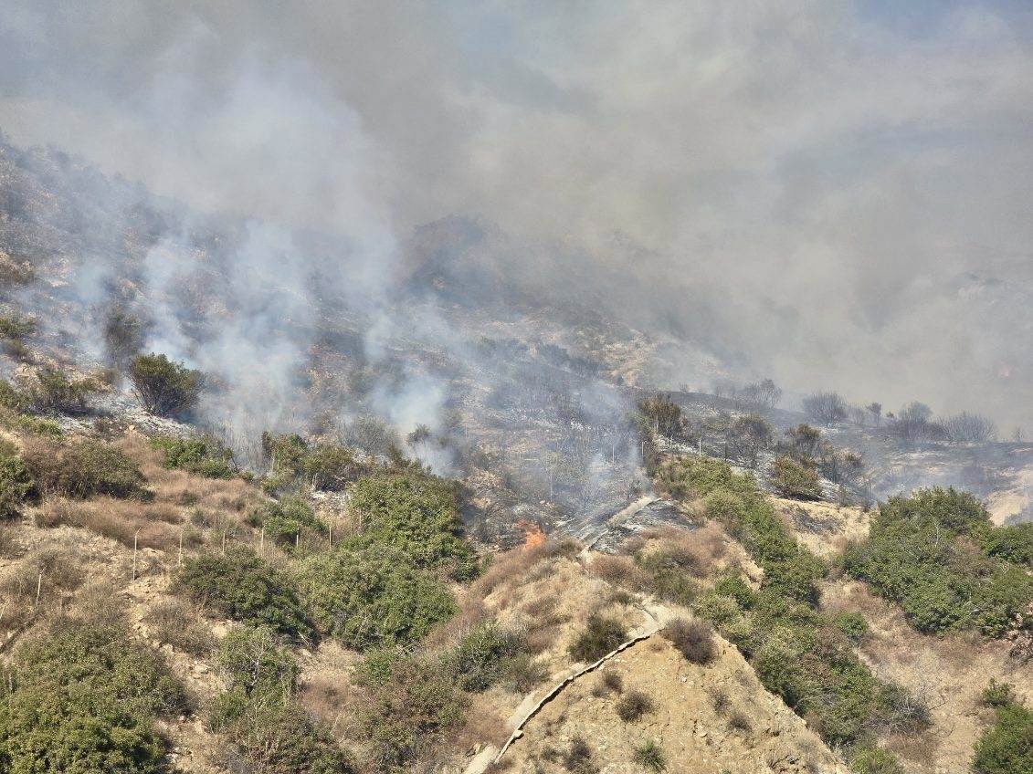
1-8-25 (ANF)
UPDATE (5:15 p.m.)
L.A. City and County officials hold a press update on the windstorm and wildfires.
UPDATE (4:53 p.m.)
The Hurst Fire is largely burning within the footprint of the 2019 Saddleridge Fire, which burned 8,799 acres , destroyed 25 structures and resulted in 8 injuries and 1 fatality.
Mandatory evacuations remain in place north of the 210 Freeway from Roxford to the Interstate 5 / 14 Freeway split, according to the Los Angeles City Fire Department.
Current satellite imagery shows smoke from the wildfires. The main smoke plume is missing the Channel Islands, but Catalina Island is likely seeing some smoke as well. Smoke models indicate near surface smoke will continue to impact much of the LA Basin into Thur AM. pic.twitter.com/x2ASHQ6H9C
— NWS Los Angeles (@NWSLosAngeles) January 9, 2025
Update (11:27 a.m.)
As of 11:27 a.m. on Wednesday, Jan. 8, the Hurst Fire has burned approximately 700 acres. It reportedly started near the 210 Freeway and Yarnell Street. Both eastbound and westbound lanes of the 210 Freeway are open for travel, but the northbound truck route will remain closed until further notice.
UPDATE (8:00 a.m.): All eastbound main line lanes of the 210 Freeway have been re-opened. Eastbound truck route lanes remain close. All westbound lanes remain closed for an unknown duration, according to CHP Newhall Area Office officials.
UPDATE (7:30 a.m.)
Fire officials are urging Santa Clarita residents to be prepared for the fast moving Hurst Fire amid intense wind storms.
As of 4:52 a.m. on Wednesday, January 8, the blaze has consumed approximately 500 acres, according to the Angeles National Forest Service. The fire reportedly ignited near the 210 Freeway and Yarnell Street.
Current Road Closures
Authorities have issued the following road closures due to fire activity:
- (Updated) Westbound I-210 at Roxford Blvd: Transition roads from northbound and southbound I-5 to eastbound I-210 are also closed until further notice.
🚧 Road Update 🚧
The EB and WB lanes of the 210 Freeway are open and clear for travel. However, please note that the NB truck route will remain closed for the time being.
Plan accordingly and stay safe on the road!@CHP_LA_TRAFFIC
— CHP Newhall (@CHP_Newhall) January 8, 2025
- Northbound and Southbound Old Road: Closed from Calgrove to San Fernando Road until further notice.
For the latest updates on road conditions and closures, visit the California Highway Patrol’s traffic website here.
Evacuation Orders
Mandatory evacuation orders have been issued for the following zones:
- LAC-E132-A: Areas near Weldon Canyon, Sunshine Canyon Landfill, and Oak Tree Gun Club in Newhall and Sylmar.
- LAC-E132-B: Same regions as above.
- LOS-E001: Specific zone details pending.
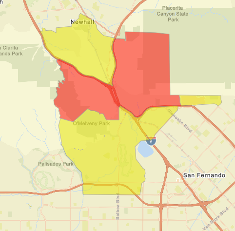
As of 8:00 AM today, there are evacuation warnings and orders related to the Hurst Fire that might impact you. Please see the map below, where yellow signifies an evacuation warning, and red signifies an evacuation order:
An evacuation order indicates an immediate threat to life. Residents are urged to evacuate immediately and follow all instructions from law enforcement to ensure safety.
Evacuation Warnings
Evacuation warnings are in place for the following zones:
- SCL-CALGROVE
- SCL-NEWHALLPASS
- SCL-WILDWOOD
- SCL-ETERNAL
Warnings signify potential danger. Residents should prepare for evacuation, gather essential belongings, and consider leaving early if extra time is needed, especially for those with large animals.
Evacuation Centers
For those displaced by the fire, the following evacuation centers are available:
- Ritchie Valens Recreation Center: 10736 Laurel Canyon Blvd, Pacoima, CA 91331
- Northridge Park: 10120 Reseda Blvd, Northridge, CA 91324
- Sepulveda Recreation Center: 8825 Kester Ave, Panorama City, CA 91402
Be Prepared
Residents in affected areas are encouraged to review the LA County Fire Department’s evacuation preparedness brochure: Ready, Set, Go.
Additional resources on evacuation procedures can be found on the CalOES website: Evacuation Information.
For real-time updates, download the Genasys Protect app or visit here.
UPDATE (11:40 p.m.): All westbound lanes of the 210 have been closed for unknown duration, according to the California Department of Transportation.
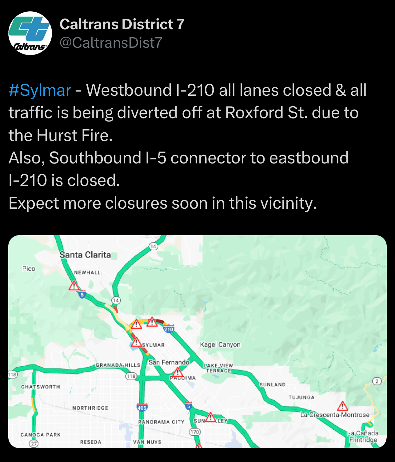
ORIGINAL STORY: The fire was at least 100 acres in size and jumped the 210, according to the Angeles National Forest.
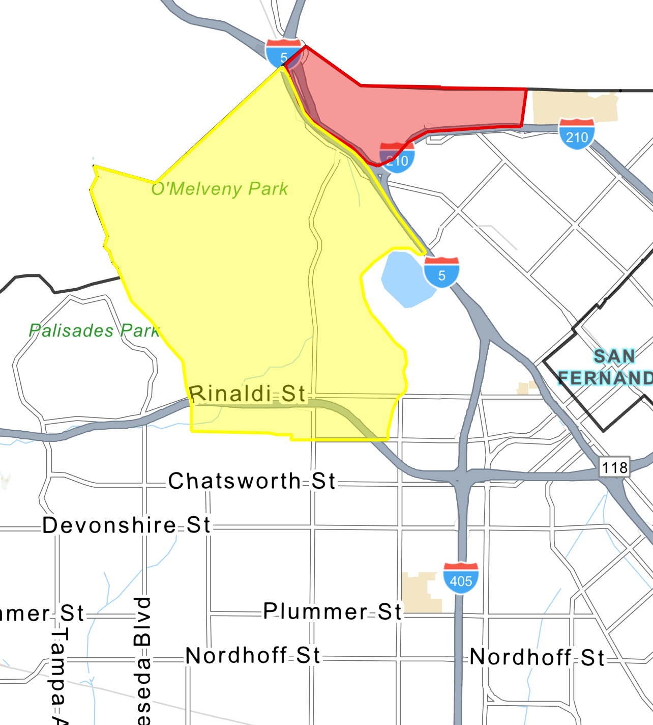
EVACUATION ORDER:
- Mandatory evacuation for North of 210 Freeway from Roxford to the Interstate 5 / 14 Freeway split
- Evacuation Warning (in yellow on map):
- 5 Freeway to Woodley/Balboa to Lahey Street to Zelzah Ave
All traffic on the 210 is being diverted off at Roxford Street, according to the California Highway Patrol.
No injuries have been reported as of 11 p.m..
Ed. Note: This is a breaking news story, more information will be added as it becomes available.
Sponsored Articles
KHTS FM 98.1 and AM 1220 is Santa Clarita’s only local radio station. KHTS mixes in a combination of news, traffic, sports, and features along with your favorite adult contemporary hits. Santa Clarita news and features are delivered throughout the day over our airwaves, on our website and through a variety of social media platforms. Our KHTS national award-winning daily news briefs are now read daily by 34,000+ residents. A vibrant member of the Santa Clarita community, the KHTS broadcast signal reaches all of the Santa Clarita Valley and parts of the high desert communities located in the Antelope Valley. The station streams its talk shows over the web, reaching a potentially worldwide audience. Follow @KHTSRadio on Facebook, Twitter, and Instagram.