KHTS Radio Santa Clarita Radio – Santa Clarita News

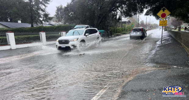
Heads up Santa Clarita – a Flash Flood Warning has been issued for the valley as heavy rain moves through the area, bringing reports of flooding to local streets, roadways and low-lying areas Monday morning.
Weather officials are warning that small creeks and streams, urban areas, highways, streets and underpasses could see rapid flooding as the storm system continues to impact the region. Areas with poor drainage are especially vulnerable, and recent burn scar zones could see minor debris flows, rockslides or mudslides as rainfall intensifies.
View this post on Instagram
The Santa Clarita Valley can expect moderate to heavy rain at times throughout the day, along with gusty winds and even a slight chance of thunderstorms as the storm moves through the area, according to Joe Sirard, meteorologist with the National Weather Service in Oxnard,
“We have a storm system moving into the area today with moderate to heavy rain at times, slight chance of thunderstorms and gusty winds,” Sirard said.
A High Wind Advisory also remains in effect for the coasts and valleys of Southwest California through 6 p.m. Monday evening. Southwest winds between 20 and 35 mph are expected throughout the day, with gusts reaching up to 55 mph in some areas. The gusty conditions could blow around unsecured outdoor objects, knock down tree limbs and potentially lead to isolated power outages.
Sirard noted that rain is expected to continue through the afternoon before tapering off later tonight, with some leftover showers lingering into Tuesday. However, a second storm system is expected to move into the region late Tuesday night into early Wednesday, bringing another round of potentially significant rainfall.
“When it’s all said and done, we could see several inches of rain,” Sirard said, adding that current forecasts estimate between one to two and a half inches for the coastal valleys of Los Angeles County, including the Santa Clarita Valley, through Wednesday night.
With roadways already becoming slick, Sirard urged drivers to take precautions while traveling during the storm.
“The main issue is flooding of roadways. People could hydroplane,” he said, noting there have already been a number of spin-outs and crashes reported across Los Angeles County due to wet conditions.
Residents planning travel through higher elevations should also be aware that snow levels are expected to drop significantly through midweek. Officials are forecasting one to two feet of snow above 5,000 feet by Wednesday night, with winter storm warnings in place for the Grapevine where even a few inches of snow could create hazardous driving conditions.
Snow levels could drop below 3,000 feet Tuesday night into early Wednesday morning, meaning lower elevation areas such as parts of Acton, Agua Dulce and the Antelope Valley could see a light dusting or up to an inch of snow.
Sponsored Articles
KHTS FM 98.1 and AM 1220 is Santa Clarita’s only local radio station. KHTS mixes in a combination of news, traffic, sports, and features along with your favorite adult contemporary hits. Santa Clarita news and features are delivered throughout the day over our airwaves, on our website and through a variety of social media platforms. Our KHTS national award-winning daily news briefs are now read daily by 34,000+ residents. A vibrant member of the Santa Clarita community, the KHTS broadcast signal reaches all of the Santa Clarita Valley and parts of the high desert communities located in the Antelope Valley. The station streams its talk shows over the web, reaching a potentially worldwide audience. Follow @KHTSRadio on Facebook, Twitter, and Instagram.